Some years ago, my obsession for travel was really sparked. Sure, I traveled for work before that and had enjoyed some other fun trips in my life. When my obsession was really sparked was when I first discovered the Oklahoma State Parks and the fact that many of them had affordable, cozy cabins in gorgeous locations. For several years, I’d been staying in one motel after another on my trips to Oklahoma, rushing from one work site to the next. Then I discovered what I had been missing and the worst of it was that the State Parks are all on the map that I had used on all my trips. Information is available on them at the Tourist Information centers in the state- places I’d never previously thought to stop at. That made me wonder what I was missing in my own area.
For a while, I developed an obsession with the brochures, maps and magazines made for tourists. I’d pick up a copy of each available and browse over them later, planning the places I wanted to see on my next trip. (Eventually, it became clear that this collection wasn’t helping me and I threw away a lot of them. But I still have a drawer or two in one of my filing cabinets filled with my favorites and I haven’t done away with the related travel obsession at all.) During this time, I also stopped at the local Visitor’s Center for Socorro and collected the brochures for the area.
I also went to the nearby Bosque del Apache National Wildlife Refuge and collected all of their brochures. One such was the brochure for the Chupadera Peak trail. I knew then that I wanted to make the climb. It lingered in the back of my mind for years. More recently, I ran across the brochure again when I pulled out my information on the Bosque to find the one for the Canyon Trail. I pulled out the Chupadera Peak brochure at the same time and left it lying on an end table in my living room.
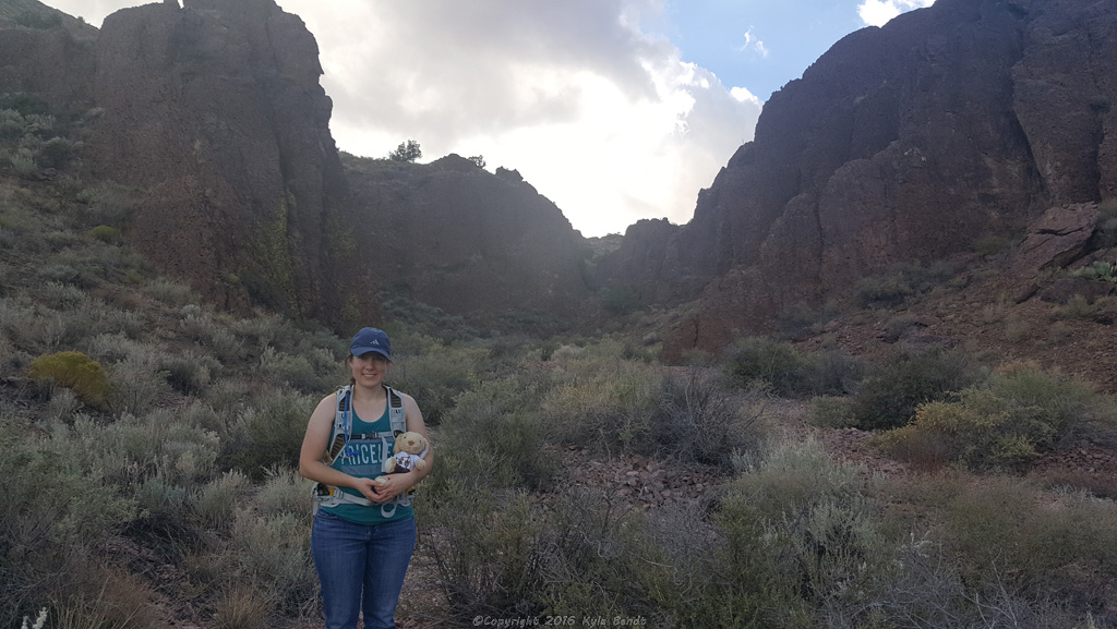
Earlier this month, Sam and I decided we were going to go do it. The Chupadera Peak trail is starts at the Bosque del Apache National Wildlife Refuge. It follows across mostly flat land for a couple of miles, goes under the interstate, enters the Chupadera wilderness area, goes up a wash for a few miles and then up to the peak. Having done the hike before, Sam recommended we just park on the interstate and go from there, saving ourselves a few miles. This is probably not the official thing that I’m supposed to recommend one do, but it seems to be kind of a thing.
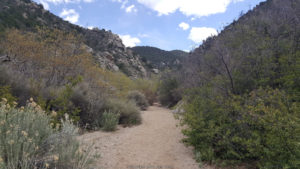
This trail winds up through very deserty terrain- filled with cactus and other deserty plants I should know the names of, but don’t. It is definitely not the sort of hike I’d recommend in the summer. An early November day however turned out to be perfect for it. We had gorgeous weather for it- partly cloudy/partly sunny and warm, but not too warm.
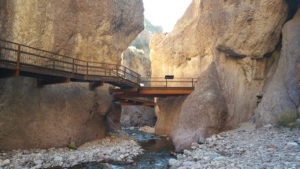
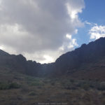
The first few miles of the trail slope gently upward, partly following the wash. Then the trail winds up through a cool canyon with red rock walls that make one think, “I’d like to go explore up in there.”
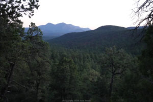
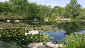
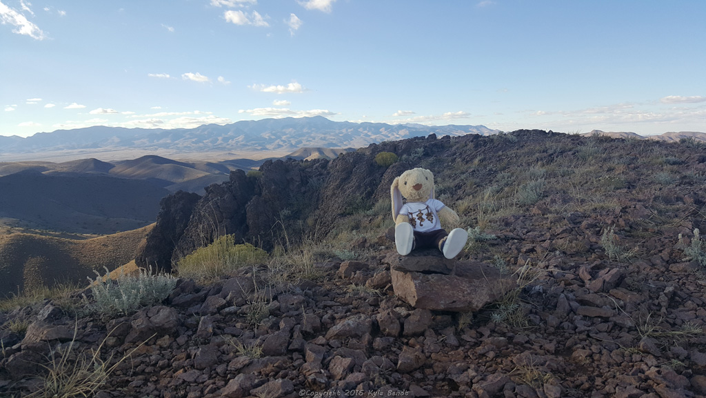
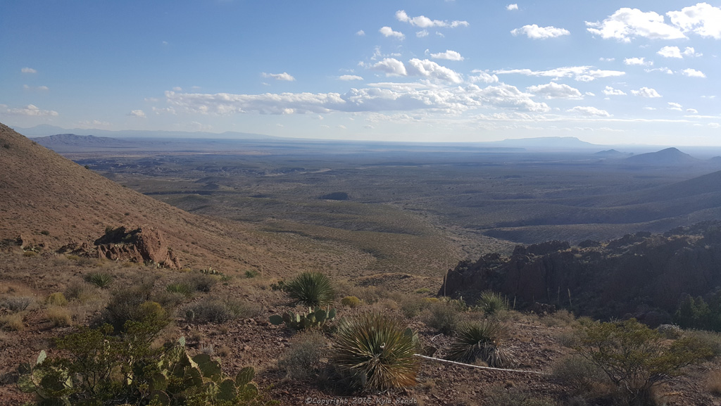
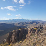
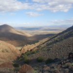
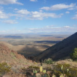
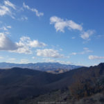
Once out of the canyon, the trail continues to wind up… and up… and up. Every time I’d think, the top has to be just a bit further and when I’d get up to where I’d been able to see to, I’d see that I still had further up to climb. It seemed as though each step higher provided a more sweeping view of the landscape below. Once you get closer to the top of the peak, it becomes possible to see the Magdalena Mountains to the east. Looking the other way, I could see the ponds and the fall colors of the Bosque del Apache down in the valley. It made me wonder if one could see the birds taking off from there.
Chupadera Peak Pictures
Click on a thumbnail to view the larger version
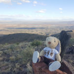
We ate sandwiches and chocolate mint cookies at the top. We drank water, and leaned against our packs, soaking up the sun. Finally, we decided it was time to head down since it was late afternoon and the sun would soon be setting.
Almost immediately upon setting out for the return trip, my left foot hurt. I tried retying my boot a few times, but nothing seemed to help. So, I figured that the faster I walked, the sooner I’d be done and I hauled butt back down the trail. The sun dropped behind the mountains and while sun rays were still visible in the distance, we were in shadow. It gave things the feeling of an ending: the end of the day, the end of the hike, the end of this post.